Broken Hill to Corner Country via Birdsville, Flinders Ranges and Bourke – if it’s not on your bucket list, it should be…
- Broken Hill to Flinders Ranges
- Flinders Ranges
- Leigh Creek to Marree
- Marree to Birdsville
- Birdsville to Big Red
- Birdsville to Innamincka
- Innamincka to Cameron Corner
- Cameron Corner to Tibooburra
- Tibooburra to Bourke


This epic adventure is perfect for seasoned travellers or those looking to experience the majesty of the Australian Outback.
It takes in icons such as Broken Hill, the Flinders Ranges, Marree, Birdsville, the Simpson Desert, Betoota, Innamincka, Cameron Corner, Tibooburra, Bourke and the Darling River.
Outback travel has never been so popular, but it can be daunting heading off into the Red Centre when you have little idea of what to expect.
That’s why we’ve pounded the corrugations, rocks and vast dusty plains to assemble a sizeable sample of Outback Australia that’s achievable for those looking for something different to a coastal blast.
Importantly, it’s one that’s accessible from our most populated centres.
You can touch on at least a section of this epic adventure within 1000km of Sydney, Melbourne, Brisbane and Adelaide.
Yet at the same time you’ll traverse some of the most arid and unforgiving terrain on the planet and take in the natural beauty of three deserts: the Strzelecki, Simpson and Sturt Stony.
Plus, you’ll see some of the most spectacular mountains in the Flinders Ranges and visit iconic towns such as Marree, Birdsville, Tibooburra and Bourke.
Oh, and we’ll make sure you have a chance to down a frothy brew (or two) at some of the best pubs you’ll find anywhere in the Outback.
So climb aboard for the ultimate Outback loop. Perfect for the seasoned traveller or for those looking for an adventurous way out of their comfort zone.

Broken Hill to Flinders Ranges
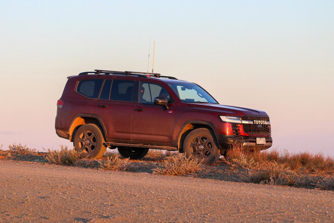
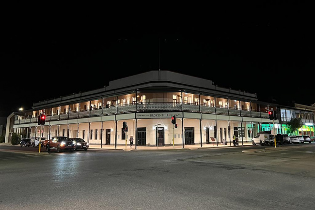
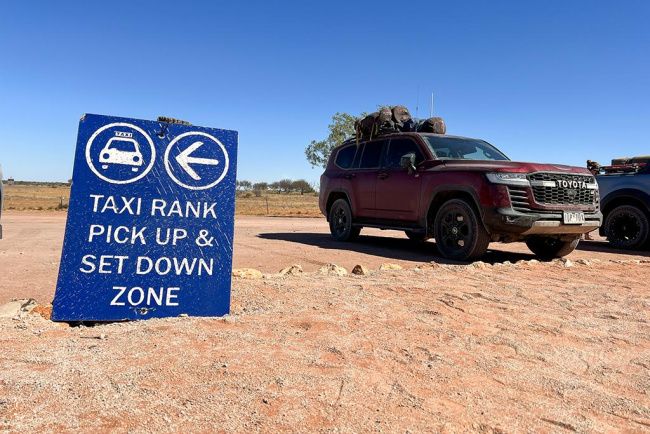
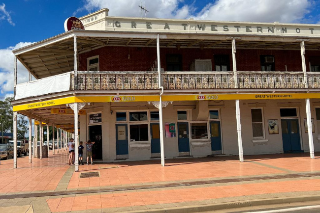
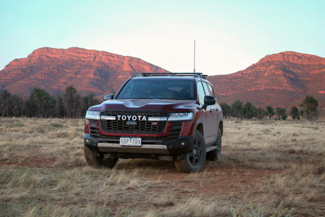
Our trip begins in the Outback town of Broken Hill. It may be in NSW, but Broken Hill – which accounts for the BH in BHP – runs on South Australian time, because Adelaide is its closest capital city.
Broken Hill has some wonderful surprises, including some of the most majestic country pubs you’ll find anywhere in Australia (the Broken Hill Pub has a great outdoor beer garden) as well as a rich artistic vein. Visit one of the many art galleries in town or explore some of the mining heritage that has shaped the town.
Bells Milk Bar injects some diner culture in the Outback and provides a dizzying array of sweet treats.
Make sure you visit the Living Desert State Park 20 minutes out of town. The orange glow from the sculptures intensifies at sunset.
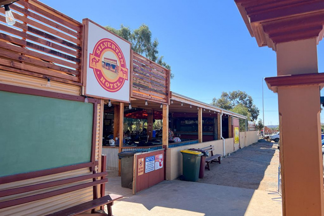
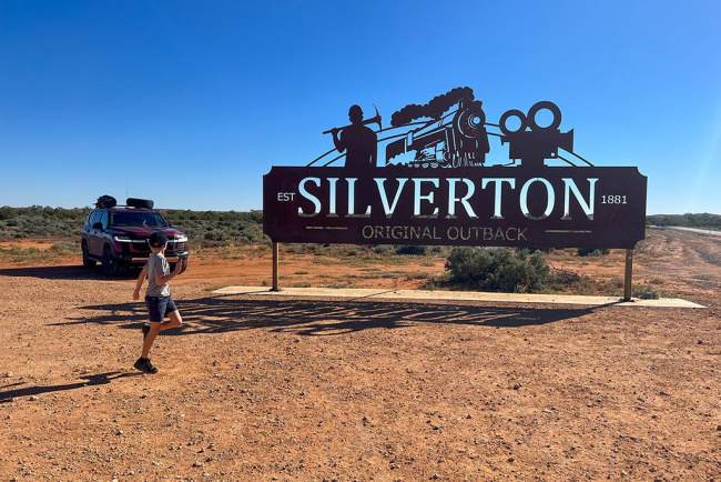
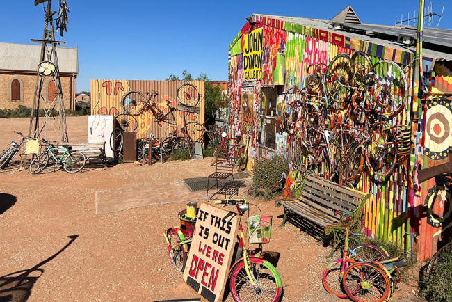
And a visit to Broken Hill is not complete without a side trip to Silverton, half an hour north-west. It’s an easy bitumen drive to a ghost town that once thrived on mining before it migrated to Broken Hill.

The Silverton pub has grown as the tourists descend on a place that has more empty blocks than standing houses.
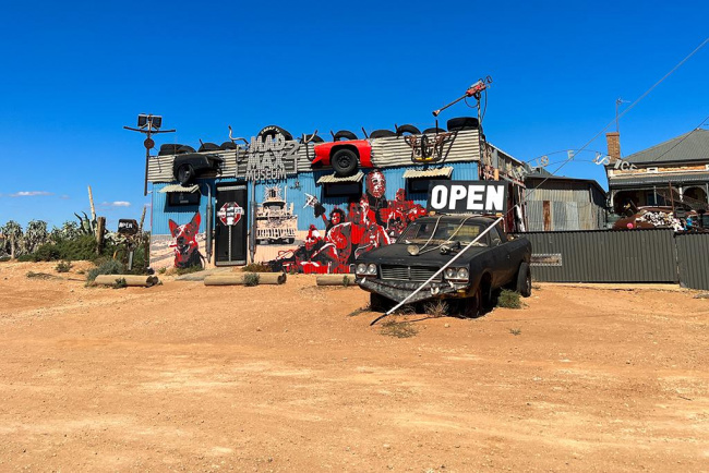
For fans of Mad Max they’ll want to check out the museum and head to the Mundi Mundi plains, where some of Mad Max 2 was filmed.
Then it’s time to hit the road to the Flinders Ranges. It’s an easy freeway drive, much of it in posted 110km/h areas.
A warning: don’t stock up on fruit and veggies just yet. There’s a quarantine station at Oodla Wirra that confiscates any banned items. Best leave that fresh food shopping to Peterborough, Orroroo or Hawker as you swing north towards the Flinders.
Some of those towns are worth more than just a stock-up on food, too. The old Holden gun at Orroroo showcases some of the World War II munitions history of Australia’s best-known vehicle manufacturer.
Flinders Ranges
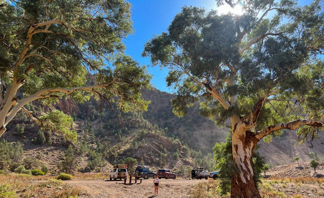
You need more than a couple of days to explore this vast area. The Flinders Ranges goes from easily accessible and popular with tourists on its western fringe through to more remote and rugged further east.
While much of the Flinders can be done in a regular passenger car, the best bits are left to a proper off-roader, especially if there’s been rain. And make sure you’ve got decent tyres or a couple of spares, because the Flinders rocks are notoriously tough on rubber.
Obvious places to visit include Wilpena Pound. Put aside a day for a walk to soak up some of the views. If you’ve up for a higher view then the tourist flights in light aircraft give a spectacular bird’s eye perspective of the area.
Or you could aim for sunset at Stokes Hill, which has an excellent 3D map of the area so you can get your bearings.
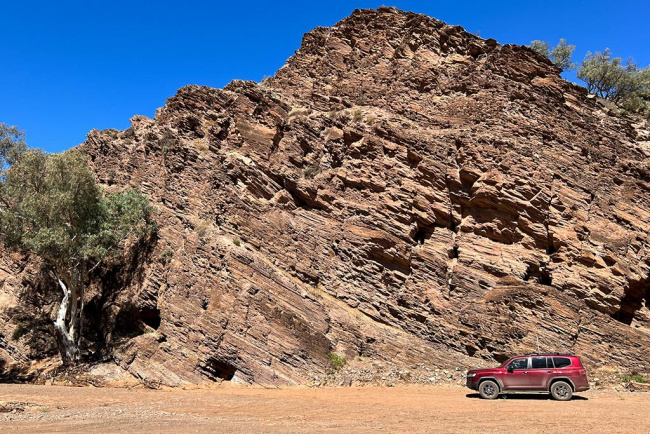
At some point you’ll have to settle in for a drive to soak up some of the geological history. The Flinders is also home to the world’s oldest fossils, dating back up to 500 million years and with surrounding rocks even older.
But for an excellent day drive head north from Wilpena before taking a left turn towards Bunyeroo Gorge.
Initially meandering through smaller hills you’ll eventually come across Razorback Lookout, which provides a postcard view of the road you’re about to drive down (it’s featured in car advertisements and many travel pieces on the Flinders).
You’ll then sink into the Gorge driving along (hopefully) dry creek beds through stunning red-tinged sedimentary rocks. Turn left at the T intersection to Brachina Gorge and it’s a short drive to even more stunning rock formations.
Continue west and the mountains fade into the rear-view mirror as you head to the open plains on the western fringe of the Flinders.
The highway north is excellent 110km/h bitumen that’ll land you in Parachilna, home to the iconic Prairie Hotel.
The pub has been recently refurbished to now incorporate its own microbrewery. But it’s the roadkill-inspired menu that lures many to the Prairie. The FMG (feral mixed grille) is a must.
From there you can head east through Angorichina and on to Blinman, home to another great pub, albeit without the tourist fanfare or fancy menu of the Prairie.
If you want to create a loop you can stick to the bitumen for the trip south back to that Stokes Hill sunset.

Just make sure you take it easy at dawn and dusk. The Flinders has a plethora of wildlife – mostly emus and kangaroos – and most have little respect for the front ends of Toyota LandCruisers or Nissan Patrols.
Once you’ve explored the southern part of the Flinders Ranges it’s time to head north.
If you’re feeling adventurous follow the mostly good gravel roads past Wirrealpa and Teatree Outstation. Again, beware of tyre damage; lowering your speed is the single biggest insurance policy against unwanted deflation.
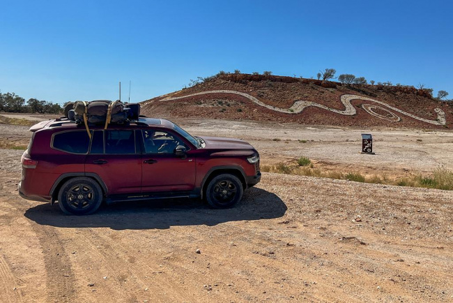
You’ll eventually end up at Arkaroola Station. This former pastoral and mining region is now a wildlife sanctuary.
Viewing of the yellow-footed rock wallabies each night reinforces the locals’ love of nature – and gives a up-close view of these animals that only populate small pockets of the country.
Arkaroola also has advanced observatories and loads of astrological knowledge to explore the universe.
Plus, there’s a range of self-drive 4WD tracks and walks to further explore the area.
When leaving Arkaroola head west towards the main road. You’ll drive through the Gammon Ranges. No matter how many rocks and jagged hills you’ve seen, you can never have too many – and the Gammons don’t disappoint.
It’s a fitting farewell to this rugged part of South Australia.
Besides, you won’t be seeing hills like this for thousands of kilometres…
Leigh Creek to Marree
Before leaving Leigh Creek it’s a good time to top up the tank, because fuel prices generally increase as you head north.
Passing Lyndhurst you’ll spot the turn-off to the Strzelecki Track, the first of the big gravel adventures.
But heading north is all easy bitumen to Marree, where the Oodnadatta and Birdsville Tracks both start.
Some Ghan Railway history provides the obligatory tourist snaps.
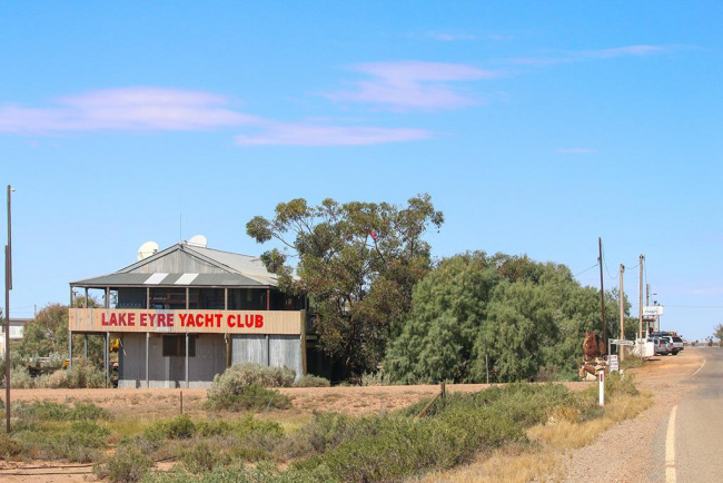
Make sure you stop into the Lake Eyre Yacht Club on the northern fringe of town. There could be few sailing clubs this far from a permanent water supply anywhere in the world. You have to admire their optimism!
Otherwise, Marree is a chance for a last-minute refuel – of car and body. It’s also the point at which the blacktop ends, at least for a couple of thousand kays.
Marree to Birdsville
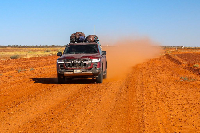
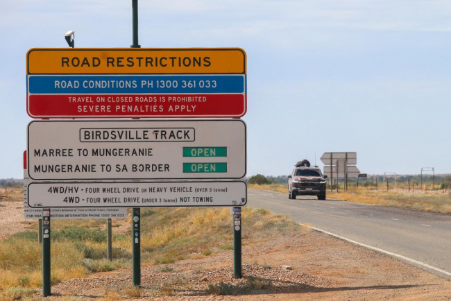
Despite the name, the Birdsville Track is usually well maintained, at least in its southern section.
Sure, there can be rocky creek crossings and occasionally punishing washouts, but for the most part it’s wide and nicely graded.
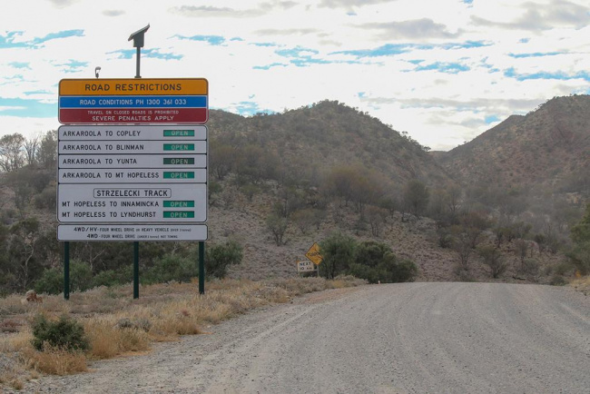
Of course, that can all change with some rain, and it doesn’t take many droplets for the authorities to close the roads.
Large signs warn if the road is closed or limited to high-clearance 4WDs. Heavy fines are in place for those who ignore the closures, although in most instances you’ll also be dealing with roads likely to be impassable in at least one section (flat terrain and red dirt is a great combination for mud that will be like nothing you’ve driven on previously).
There’s a vastness to the expanse that is littered with rocks, more so as you head north.
The so-called gibber plains are a stunning orange backdrop against the blue sky that somehow seems wider, more expansive in the Outback.

Lines of trees indicate creek beds, most of which will be dry, unless water is making its way from further north.
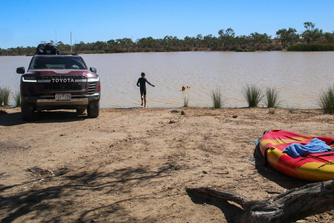
Those creeks can make good campsites, although one of the better ones is at Cooper Creek, one of the main arterials in the region.
It’s an official campground, although it’s unlikely to be busy. Traffic in these parts isn’t too thick…
The camp area is well marked and there’s even a flushing toilet, which is a luxury in the Outback. Best to bring your own firewood, though, because the area is often well groomed of tree litter.
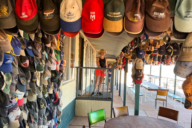
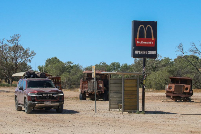
By the time you head into Mungerannie you’ll be ready for a refresher. It’s the only defined stop along the Track and makes for a welcome reprieve from the openness elsewhere.
The unassuming pub – which is basically the whole of Mungerannie – doubles as a petrol station and place for a feed. The mock McDonald’s sign out the front fortunately isn’t backed up anywhere vaguely nearby.
It’s also loaded with character, with hats, bras and souvenirs left from former travellers hanging from the roof.
As the Track heads north the gibber plains intensify and you’re more likely to experience less hospitable sections of gravel.
Vibrant red dunes penetrating south from the Simpson break up the flat plains.
The main Birdsville Track continues north or you can consider the inside track; it runs through a floodplain so will not be accessible at certain times (check road conditions before you get there).
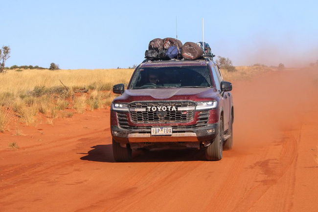
Birdsville to Big Red
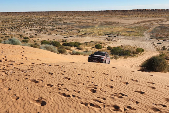
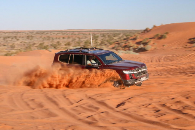
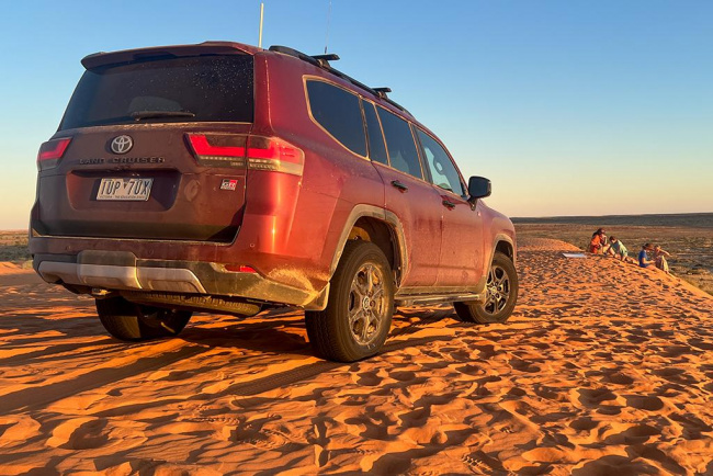
If you’ve made it to Birdsville then Big Red is a must. It’s an easy half-hour drive from town.
The easternmost sand dune of the Simpson Desert is also one of the most accommodating and easily accessible, with a large car-friendly expanse up top.
It also gives a taste of what to expect if you are planning on tackling all 1100 dunes of the Simpson.
Provided there hasn’t been rain, the run west from Birdsville is an easy one that crosses some smaller dunes over mostly well-maintained roads.
Rougher sections over the last few kilometres give an inkling of the Outback’s unforgiving nature.
While it previously required detailed maps or some local knowledge to locate the turn-off to Big Red, these days it’s well marked.
Soak up Little Red (the southern section of its bigger brother) before heading north for a few kilometres along a meandering track at the base of the dune.
Then it’s time to take some air out of the tyres before ascending to what is a spectacular bowl of red sand.
Big Red’s eastern approach is usually easy going, although the western approach typically provides a sharper angle with softer sand. Multiple approaches from the west give options depending on what sort of challenge you’re after.
Switch the UHF to channel 10 to keep in touch with other travellers and warn them when you’re ascending a dune. A sand flag can also be handy (it’s mandatory if you’re continuing through the Simpson and crossing the border to South Australia).
The second sand dune (sometimes called Nemesis) typically provides more of a challenge and is among the toughest in the Desert. You’re here, so may as well give it a go!
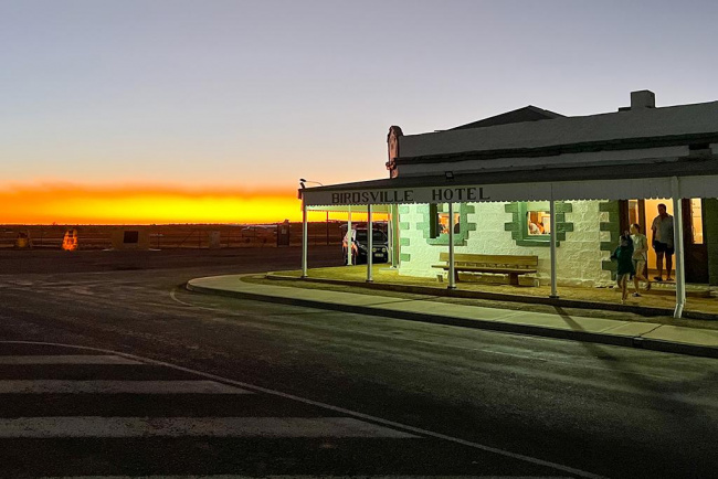
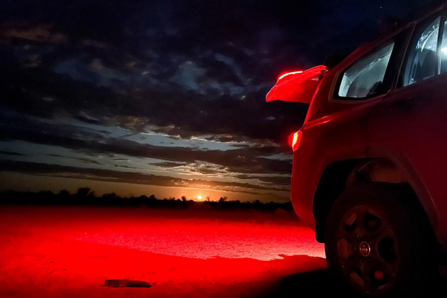
If you’ve got the time, a sunset on Big Red is worth the wait. The pub will still be serving beer by the time you make it back to Birdsville.
Birdsville to Innamincka
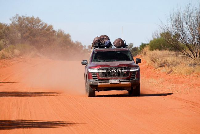
The road east out of Birdsville is usually very easy and these days there are even patches of bitumen to smooth some of the rougher sections.
High-speed gravel means there’s the persistent threat of punctures, so if you’re concerned then back off the speed to reduce the risk.
Keep an eye out for wildlife, including cattle.
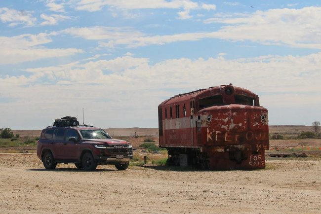
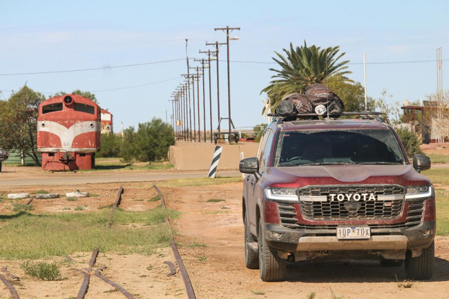
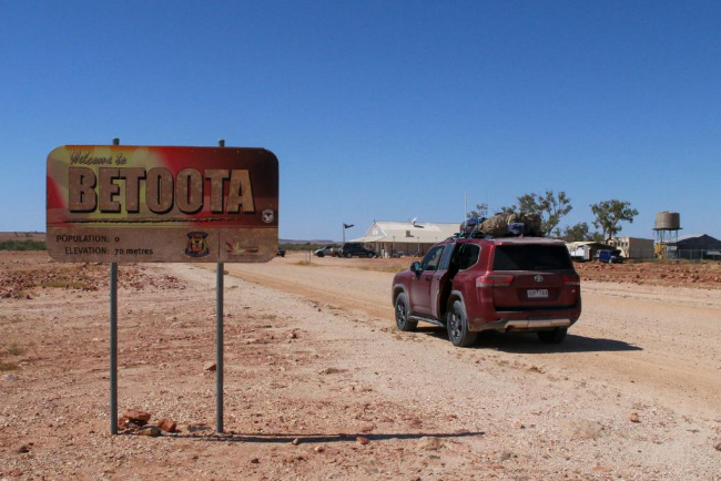
But keep things motoring and you’ll eventually hit Betoota. Better known for the satirical website that borrows its name, the town is little more than a pub that only reopened in 2019 after a couple of decades of lying dormant.
A few kilometres before you get there is the Dreamtime Serpent, impressive indigenous rock art sprawling across a gentle hill.

The Betoota is one of those instantly cool pubs that also happens to have some cool cars floating around its periphery. The owner was previously involved in V8 Supercar racing in Australia and has continued his love of things on four wheels.
Hit some pool balls while you wait for a pie or beer or just soak up the atmosphere. There are definitely worse watering holes in the Outback.
If you’re up for more adventure, backtrack towards Birdsville and turn down the Cordillo Downs road. Soon after the turn-off the remains of the Cadelga homestead are some of the more picturesque ruins in this remote, desolate part of the country.
Not much further along is the Cordillo Downs shearing shed. Pop your head in to soak up the stone construction of what is the largest of its type in the world.
By now you’re thick in rocky gibber plains and the road is often rough and unforgiving. It can be slowing going, at least if you want to look after your rig.
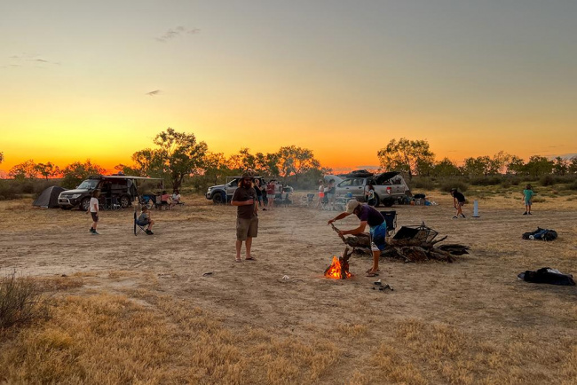
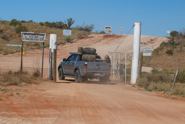
Heading into the Innamincka Regional Reserve provides some excellent camping opportunities nearby the various (dry) creeks that occasionally flow.
But remember to buy a Desert Parks Pass before rolling out the swags.
Those wanting an easier run can stay on the Birdsville Development Road before heading south on the Planet Arrabury Road. It usually gets more grader love than the Cordillo Downs Road, so is often easier going, although it’s still remote and unforgiving country.
A diversion to the Burke and Wills Dig Tree gives an insight into the perils of the early European explorers. The road into the visitor area is rougher than anything in the surrounding area, so you’ll be travelling slower.
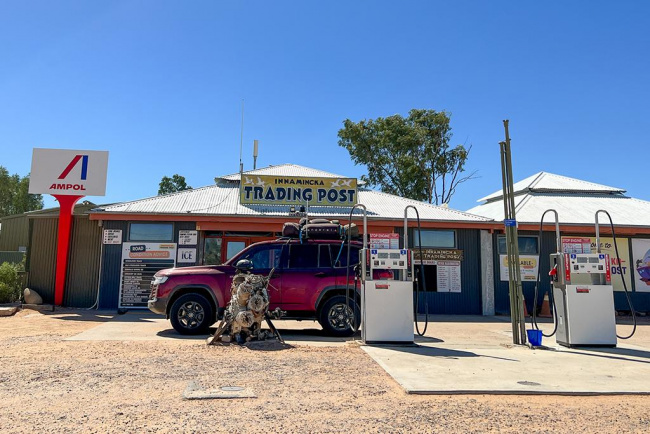
Then it’s an easy run to Innamincka, a rare (small) pocket of civilisation among the mostly baron moonscape.
As well as a pub and general store, Innamincka has a plethora of camping options back on the Cooper Creek (yep, the same one).
Even if you’re not staying it’s worth a wander along the banks of the river to see the friendly turtles that inevitably come begging for scraps.
Innamincka to Cameron Corner
Heading south on the Strzelecki Track is mostly easy going, in part because you’re heading towards mining country, so the roads tend to be in better nick.
The Moomba gas fields are further along and the mini community that thrives there uses these roads regularly, so they tend to be well maintained.
If you’re after something a little rawer, turn down the Old Strzelecki Track. It’s more single track rather than the broad expanses of gravel that is the Strzelecki main.
You’ll likely see fewer travellers but more wildlife. And the scenery goes through variations, from vast open expanses to scrubby narrow sections.
The campsites alongside the sand dune near Merty Merty make a great place to pull up stumps.

Don’t have a big brekky, though, because the road towards the corner is an up and down affair. Traversing the smaller dunes means there’s an element of roller coaster to the snaking strip of gravel that could have wandering cows or washouts on its edges.
It’s a big change to the more open stretches common elsewhere – and at the very least commands more attention.
At the Corner you may have to wait your turn to take the obligatory pics of having body parts in Queensland, South Australia and NSW at the same time.
Oh, and don’t forget to look for the small marker on the ground (it aligns with where the two barbed wire fences would intersect if they weren’t joined by a diagonal); that’s the real marker point denoting the intersection of three states.
Also don’t forget to sample their beer. It’s cold…
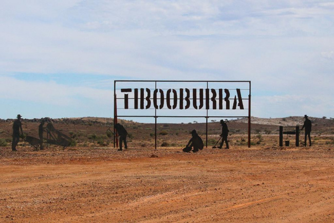
Cameron Corner to Tibooburra
From the Corner store you’ll almost immediately head through one of the most serious fences in the Outback. The dog fence is taller and more robust than most Outback fences, designed to keep dingoes out of NSW and needs to be manually operated.
The regular road that broadly runs east-south-east is not quite as up and down, although there are enough rises and corners to catch you out.
Large western barred bandicoot sculptures break up the countryside and celebrate the efforts to turn the Sturt National Park into a feral predator-free area.
You can continue along the main road, which at one point crosses a vast claypan; check that it’s dry before venturing across. It’s desolate country…
Those wanting a more picturesque route will be better served by taking the Middle Road turn-off. The road immediately narrows and is more vegetated, a result of the eradication of stock to return it to something closer to what it would have been prior to European settlement.
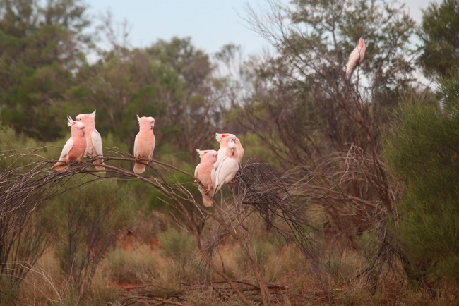
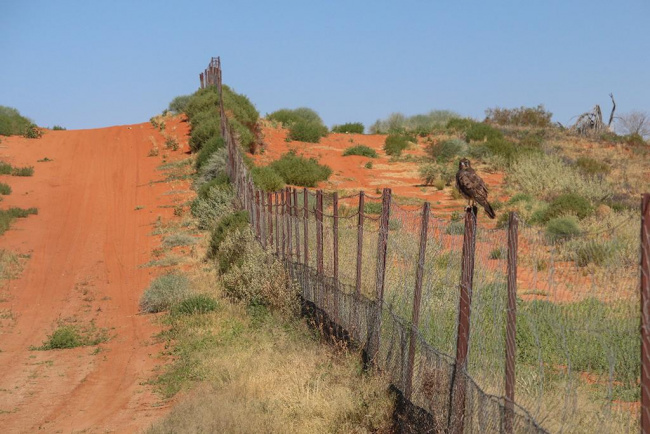
There are pockets of surprisingly dense vegetation, something that’s attracted its fair share of birdlife, among others.
Things soon open up into former pastoral lands and more gibber plains before you join up with the main road for a gentle last few kilometres into Tibooburra.
Compared with where you’ve been, Tibooburra is almost an oasis. There are two pubs, for starters, and two places to refuel.
So while you won’t be held up in traffic, there’s at least more in terms of population.
Schedule in some time to head to the ghost town of nearby Milparinka, which has some significant Bourke and Wills sites as well as another worthy Outback pub. There are also the relics of a former thriving town, one of many in the Outback that these days is more rocks and rubble.
Tibooburra to Bourke
It’s amazing how a cheeky 400-odd-kilometres can somehow seem like it’s just around the corner. But that’s the nature of Outback travel.
The road out of Tibooburra initially continues the vast, featureless theme, creek crossings the main thing breaking up the red rocks.
But before long the scrub thickens, which in itself brings its own challenges. It’s one thing having emus and kangaroos around; it’s another when you can’t see them until the last second.
The road is mainly well maintained, although as with all Outback roads it can be variable, especially after rain or lots of traffic.
The tiny town of Wanaaring provides a respite from the gravel, although don’t go getting excited about the pub; it’s been closed for a couple of years, with the main interaction instead with a general store that also supplies fuel.
You can continue into Bourke to then get an insight into the once-bustling town that relied on the transport supplied by the river.
Or you can cut off earlier and head more directly to the Darling River Run.
Various stations now offering stunning riverside campsites, most now with facilities.
The Tilpa pub is worth a diversion, or you can learn more about the history with a tour of Dunlop Station or morning tea at Rose Isle.
Then it’s a short hop back to Sydney to complete what is one of the best tastes of the Aussie Outback.
Outback planning tips:
• Phone range is often marginal in the Outback, although many towns will have some sort of coverage. Telstra offers by far the best range, although occasionally you’ll find a pocket where Optus is the only option (Mungerannie, for one). As for Vodafone, forget it. It’s all but useless out here.
• It doesn’t take much rain to close Outback roads. Once closed, they’re closed for a reason, usually because they’ll be so waterlogged that you’ll be unable to pass or because the level of water will churn up the road surface to the point of being undeliverable for cars that follow. Big fines typically apply for tackling closed roads, so be flexible and settle in wherever you are until they reopen.
• A UHF radio can be a great way to stay in touch in the Outback, especially if you’re travelling in a convoy. Even touching base with oncoming traffic can give you an idea of what the roads you’re about to drive on are like.
• Also consider back-up communication. A sat-phone is the obvious one. You could also consider the Starlink internet service, which is available as a mobile system to give you full coverage across the country.
• Get your car serviced before taking off on a trip like this.
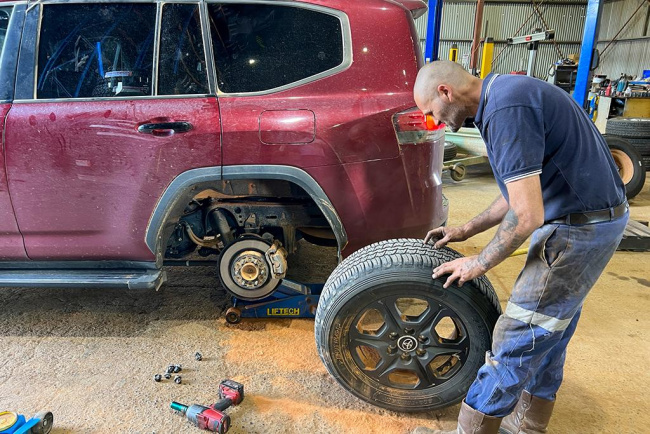
• Tyres are often the weak link on an Outback trip. If your car doesn’t already have them, consider tyre pressure sensors and a second spare.
• Carry plenty of water and always aim to leave a town topped up. Some places, such as Innamincka, have vending machines for water, while others will allow a fill from a rainwater tank or the local filtered bore water; check with the locals and get permission first. General stores also usually sell boxed water.
Keyword: The ultimate Outback trip