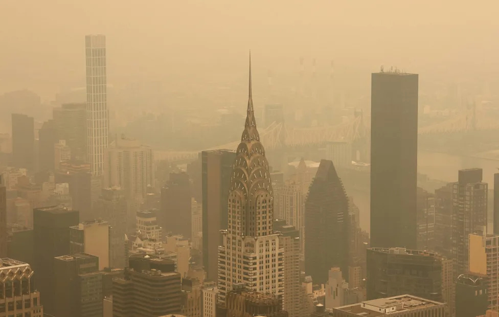



















Hazardous AQI Plunges 17 States Into Code Red As Smoke Swallows I-75, I-94, and I-95Autoblog and Yahoo may earn commission from links in this article.A thick wall of wildfire smoke has turned skies over the eastern half of the country a milky orange, and it is now a driving hazard as much as a health one. Smoke from dozens of out-of-control fires in western Ontario and a cluster of intensifying blazes in northern Minnesota has flooded the Great Lakes and slammed into the Interstate 95 corridor, dropping air quality to hazardous levels from the Upper Midwest to New England. Officials are urging drivers to expect hazy, low-contrast conditions on major routes and to treat the smoke like any other visibility threat.The peak danger is right now: Detroit's air quality index climbed toward an astronomical 600 Thursday morning, roughly double the threshold where air is officially "hazardous" for everyone, and the thickest bands of smoke can cut highway visibility with little warning.What to ExpectThe core of the plume is parked over the Great Lakes and Northeast, and a shift in winds pulled heavy smoke south into the Lower 48 and toward the I-95 corridor. FOX WeatherAdvertisementAdvertisementExtreme air quality readings. Detroit and Minneapolis ranked among the worst major cities in the world for air quality Thursday, with Detroit's AQI near 600. For context, the "hazardous" category begins at an AQI of 300. ABC NewsABC NewsWidespread official alerts. Pennsylvania declared a Code Red air quality alert for Thursday, and Massachusetts issued alerts statewide. Parts of northeastern Minnesota hit the purple AQI category, considered very unhealthy for everyone. CBS NewsMinnesota Pollution Control AgencyReduced visibility risk. Forecasters warned that visibility may drop under the thickest bands of the plume, with a possible six-to-eight-hour window of smoke settling near the ground. NewsRadio 840 WHASOrange, low-contrast skies. The event is drawing comparisons to the June 2023 outbreak that turned New York City orange, and daytime glare through haze can make lane markings and brake lights harder to read.Road ConditionsSmoke visibility is not the same as fog, but it behaves like it on the road: contrast flattens, distances get harder to judge, and headlights and taillights lose punch. The heaviest impacts track the metro corridors already under alerts. Around Detroit, that means I-75, I-94 and I-96 running through some of the densest haze in the country. In Minnesota, I-35 and I-94 out of the Twin Cities and up toward the Arrowhead sit closest to the fires. Across the Northeast, the I-95 stretch through Boston, New York City and Philadelphia took the leading edge of the plume overnight. Where smoke mixes down to the surface, expect a sudden drop in sight distance on open stretches and near interchanges.Where the Smoke Is Headed NextThe plume is not done moving. By Friday morning the smoke is expected to push farther south into Ohio and Virginia, including the Washington, D.C. area. That puts the I-70, I-71 and I-75 corridors through Ohio and the northern Mid-Atlantic in line for the next round of haze and degraded air. Drivers planning Friday trips through the Ohio Valley and toward the capital should check conditions before rolling.Low-Visibility Driving TipsUse low-beam headlights, not high beams. High beams bounce off smoke particles and reflect glare back at you, exactly like fog.Back off your following distance. Reduced contrast makes it harder to catch sudden braking ahead, so add cushion.Keep the cabin air on recirculate. Closing the fresh-air intake helps keep fine particulate out of the cabin on longer drives.Slow down on open and exposed stretches. Smoke can thicken fast where it settles near the ground, especially around dawn.Check real-time conditions first. The AirNow Fire and Smoke Map shows where the densest plumes and worst readings are before you leave.TimingThe worst air across the Great Lakes and Northeast is centered on Thursday, with hazardous readings and the highest visibility risk during the daytime hours. Alerts run through at least Thursday across much of the region, with the plume shifting south into the Ohio Valley and Mid-Atlantic by Friday morning. Because the fires remain uncontained and winds are steering the smoke, timing can change quickly, so treat any posted air quality alert as the current best guide.AdvertisementAdvertisementThis story was originally published by Autoblog on Jul 16, 2026, where it first appeared in the News section. Add Autoblog as a Preferred Source by clicking here.