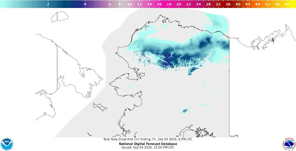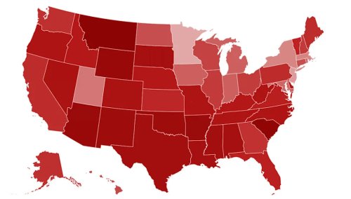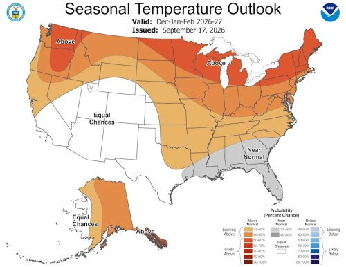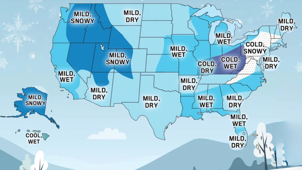

















New Map Shows Big Snow Coming to 4 Regions of America This WinterAutoblog and Yahoo may earn commission from links in this article.Four regions of the United States are being told to expect more snow than usual this winter, and the country's oldest weather publication has put dates on each of them. The earliest window opens in late November, which is before most drivers have swapped tires.Where the Big Snow LandsThe Old Farmer's Almanac winter map marks four areas for above-normal snowfall, each with its own set of dates for the heaviest stretches.RegionSnowiest periodsCentral New England through the AppalachiansMid- and late December, mid-January, February, early and late MarchIntermountain WestLate November, late December, early FebruaryPacific NorthwestLate December, mid-January, mid-FebruaryAlaskaMid-November, early and late January, mid-February, late MarchThe eastern band is the only one of the four getting its snow with below-normal temperatures, and the Almanac has it heaviest in the northern half of that band, across Pennsylvania and western New York. The Intermountain region covers the largest footprint, running from eastern Washington and Oregon through Idaho, Utah and Nevada into western Colorado. The Almanac forecasts by region rather than by state, and several of those regions cut states in half.AdvertisementAdvertisementEditor-in-chief Carol Connare framed the season as one that "won't look the same everywhere," and the map bears that out. Most of the country sits outside these four snow zones.Warm Snow Is Different Snow, and Harder on DriversThree of the four snowy regions are also forecast above normal on temperature. The Intermountain West, the Pacific Northwest and Alaska all get more snow than usual while running warmer than usual. Only the eastern band gets its snow with real cold behind it.Warm storms drop wet, dense snow at pass elevation and rain a few hundred feet below, then refreeze overnight into ice rather than settling as powder. Alaska produced a working example of it this week, when a Winter Weather Advisory put four to six inches on Atigun Pass with temperatures in the upper 20s while both ends of the same highway sat in 50-degree rain. A driver running the Dalton crossed into winter and back out of it inside a few hours without changing roads.Michelin puts the point where all-season rubber starts stiffening at 45 degrees Fahrenheit, well above freezing, so a warm snowy season can leave drivers on compromised tires for weeks while the pavement still looks bare.AdvertisementAdvertisementPavement gets it too. Water gets into a crack, freezes, expands, then melts and leaves a void that traffic collapses. Minnesota's transportation department lists the ingredients as moisture plus varying temperatures that keep the freeze-thaw cycle in motion, which is why a season spent crossing back and forth over freezing does more damage than one that stays frozen. Every one of those cycles also brings another round of brine and salt, and it ends up in wheel wells and brake lines.The El Niño Behind ItThe Almanac points to a strong El Niño as the main driver, and federal forecasters agree something unusual is building. The Climate Prediction Center's August ENSO discussion carries an El Niño Advisory and puts the odds of a very strong event above 90 percent for fall and winter, with a 69 percent chance that October through December produces an event stronger than anything on record since 1950.Strong El Niño winters typically push the wet signal into the West and the southern tier, which covers two of the Almanac's four snow zones.El Niño is not the only signal in the forecast. The Almanac also leans on solar activity, which is waning as Solar Cycle 25 comes off its peak, and on slow-moving ocean patterns in the Atlantic and Pacific. It flags one wildcard by name: the polar vortex. If it shifts south, Canadian air pushes farther into the United States, and the mild half of the map stops being mild.Final ThoughtsThe Almanac's formula is proprietary and it publishes no verification record, so this is a planning document, not a route decision. That comes from your state DOT and the local National Weather Service office inside 72 hours.AdvertisementAdvertisementThe useful part of the map is the calendar. Every one of the four zones has its first snow window marked before the season most drivers think of as winter, and two of them open in November. If you drive in any of them, the move is to get the winter set mounted against those dates rather than against the first storm, and to set up an undercarriage wash schedule if you are in the West, where warm snow means more brine on the road and more of it sitting in your wheel wells. Both are cheaper in September than a bent rim in March.This story was originally published by Autoblog on Aug 29, 2026, where it first appeared in the News section. Add Autoblog as a Preferred Source by clicking here.